|
|
|
ROUTES
|
|
|
|
|
|
 |
|
TVIBERI
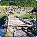
The route follows the Tviberi River valley from the village of Zhabeshi to
the north and goes to Kvitlodi and the Tviberi glacier. The total length of
the route is 5.5 km, The altitude difference between levels 730 m, walking
time - 6 hours.
|
|
|
|
|
|
|
|
|
|
|
|
|
 |
|
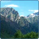
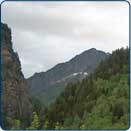
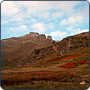
USHBA
The route consists of two simple sections, the length of each section
is 5.5 kilometers and a difficult three kilometer stretch. The altitude
difference between levels is 230 metres on the first section, and 870 m - on
the second. The total walking time is 8-9 hours.
|
|
|
|
|
|
|
|
|
|
|
|
|
 |
|
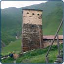
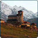
SKHARA
The route is leading us to Ushguli community - its unique architecture
and cult monuments and its stern and beautiful surroundings. The trail links
Ushguli and the head of Inguri River. The length of the route is - 9
kilometres, walking time - 5-6 hours.
|
|
|
|
|
|
|
|
|
|
|
|
|
 |
|
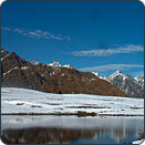
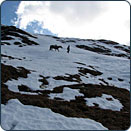
CHALAADI
The route approaches the Chatini Summit, up to the tongue of the Chalaadi
Glacier. The length of route is about 6 km, walking time - 5-6 hours.
|
|
|
|
|
|
|
|
|
|
|
|
|
 |
|
ZHABESHI - USHGULI
It is a three-day horse trail with an overnight stop in the village of
Adishi and Ifrali. The length of the trail is 30-40 kilometres. It goes
through two mountain passes and is characterized by a variable hypsometry
The elevation of the route varies from 1,690 to 2,700 metres above sea level.
|
|
|
|
|
|
|
|
|
|
|
|
|
 |
|
MESTIA - TSVIRMI
This trail acquaints us with beautiful surroundings of the Enguri
River valley and villages of Tsvirmi community.
|
|
|
|
|
|
|
|
|
|
|
|
|
 |
|
MESTIA - KORULDI
The route is circular: it aims to acquaint us with the
historical Legtagi and Lanchvali neighbourhoods of Mestia and their
surroundings.
|
|
|
|
|
|
|
|
|
|
|
|
|
 |
|
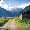
MESTIA - MAZERI
The route connects the borough of Mestia with villages of Becho
community located in the Dolra River basin. The Ushba-Mazeri
massif, one of the most inaccessible and austere mountain
massifs of the Caucasus, is continuously visible along the route.
This is one of the routes that take you as close as you can get
to Mt.Ushba.
|
|
|
|
|
|
|
|
|
|
|
|
|
 |
|
MAZERI - ETSERI
The route goes from Becho community to Etseri community
via the Baki pass crossing woodlands and alpine meadows.
|
|
|
|
|
|
|
|
|
|
|
|
|
 |
|
USHGULI - MAMI
The route connects villages of Upper Svanetis Ushguli
community, which is the highest in Europe, with the village of
Mami in Lower Svaneti via the Latpari pass. It allows us to return
to Tbilisi via a new road that goes through the beautiful
surroundings of the Svaneti Ridge and Lentekhi and shortens the
distance to Tbilisi by 120 km.
|
|
|
|
|
|
|
|